Mapping remote highland ecosystems on Serra do Aracá
A team of 16 researchers spent 19 days investigating biodiversity in the highland ecosystems of Serra do Aracá in northern Amazonas. The expedition completed a major mapping effort to document endemic species and historical climate changes in these isolated sky islands.
Reviewed by Matheus Grangeiro
- Sample size
- 16
Key numbers
16pesquisadores
number of researchers in the expedition team
19dias
duration of the fieldwork investigation
1.260metros
altitude of the main plateau camp
1metro
approximate depth to sandstone bedrock
1.260m
altitude of main plateau base
850m
altitude of secondary camp Aracazinho
220km
distance from operational base in Barcelos to the site
17militares
number of military personnel supporting the field work
Evidence level: Observation or measurement
Why it matters: Highland ecosystems of the Amazon remain poorly documented because remote terrain and extreme logistics restrict access. Taxonomists, conservation planners and the communities that depend on intact forest lack baseline inventories for these isolated plateaus. The specimens, tissue collections and environmental DNA (eDNA) samples gathered here are intended to supply that baseline, although formal species descriptions will take years.
How researchers captured biodiversity across elevation camps
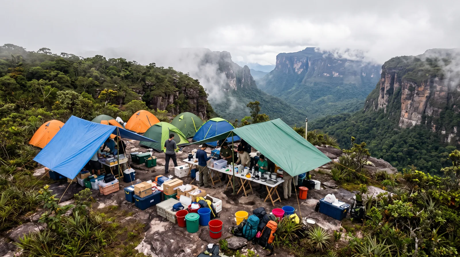
Sixteen researchers spent 19 consecutive days surveying the highland ecosystems of Serra do Aracá, in the far north of Amazonas State, between late August and mid-September 2026. Seventeen Brazilian Army soldiers supported the fieldwork, and a Black Hawk helicopter flying from Barcelos, 220 kilometers away, moved more than 5 tons of cargo. The team worked from two bases: a main camp on the plateau at 1,260 meters and a secondary site, Aracazinho, an eroded outlying elevation at 850 meters. The team, coordinated by Miguel Trefaut Rodrigues, professor emeritus at the Institute of Biosciences of the University of São Paulo (USP), spanned botany, palynology, herpetology, ornithology, mammalogy, invertebrate zoology and parasitology.
Each method sampled a different slice of the fauna. One hundred fifty plastic buckets, buried as pitfall traps, intercepted amphibians, lizards and snakes. Autonomous acoustic recorders registered ultrasound up to 384 kilohertz, far above the roughly 20-kilohertz ceiling of human hearing, so that bats and other vocalizing organisms could be compared against reference sonogram libraries. Camera traps, triggered by heat and motion sensors and strapped to trees, recorded medium and large mammals, small rodents and marsupials.
Navigating the isolated sky islands of the Amazon
Expedition Tulu-Tuloi, named for the larger mountain complex that includes the Aracá tepuis, closed a three-stage biodiversity mapping project funded by the São Paulo Research Foundation (FAPESP) with Army support. Earlier stages at Pico da Neblina (2017) and Serra do Imeri (2022) were productive: the former yielded two new frog families and two Riolama lizard species, whereas the latter produced a new bird species, additional frogs and a new genus of freshwater crab.
The Aracá belongs to the Roraima Formation, sandstone plateaus roughly 2 billion years old that began fragmenting in the Cretaceous. Erosion carved deep valleys into this block and isolated the resulting tepuis, known as sky islands. Isolation is the biological point: populations stranded on separate summits diverge. Because the Aracá lies on the boundary between the eastern and western tepui sub-regions, its fauna is particularly informative about how lineages across the region are related.
From physical fieldwork to laboratory genomic and climate reconstruction
Field samples now enter two laboratory pipelines, one genomic and one climatic. The haul comprises 7,000 to 11,000 insects representing roughly 200 to 350 morphospecies, about 2,000 herbarium sheets from 400 plant collection numbers, some 200 birds, and about 100 small mammals. Among reptiles and amphibians, five of nine lizard species and roughly ten of 18 amphibian species are candidate new taxa, as is one snake.
Five sediment columns, 50 centimeters to 1 meter long, will undergo carbon-14 dating and pollen analysis to reconstruct vegetation and climate back to the last glacial period, about 20,000 to 30,000 years ago, or at least across the past 5,000 years. Metagenomic sequencing of soil and water will then survey vertebrates, viruses, bacteria and fungi. Traditional collecting and visual surveys miss cryptic and rare species; combining pitfall traps, ultrasonic recording, camera traps and eDNA extraction therefore yields a more complete inventory. Voucher specimens will be deposited in collections at USP and the National Institute of Amazonian Research, and plant material will be distributed among herbaria and botanical gardens. Fieldwork is finished. Sequencing and dating are still ahead.
What physical specimens and preservation techniques revealed
Specimens were documented in field notebooks and photographed alive in a portable studio under natural light, because original coloration fades after fixation in 10 percent formalin and storage in 70 percent ethanol. Agustín Camacho, of the Autonomous University of Madrid, ran maximum voluntary temperature trials on ectotherms such as lizards with a non-invasive portable system, a metric relevant to forecasting how montane species respond to warming.
Tissue work extended well beyond morphology: liver and muscle were set aside for genetic and molecular analyses, and chromosome material for cytogenetics. Parasites received equal attention. After euthanasia, parasitologist Bruno Fermino, of the Federal Institute of Amazonas, drew blood to study hemoparasites, including Trypanosoma, a protozoan genus that includes the agent of Chagas disease. Botanists, meanwhile, drove PVC pipes into peat until they struck sandstone bedrock at about 1 meter.
What the fieldwork alone does not show It may seem that fieldwork alone provides a complete picture of the ecosystem’s taxonomy, its past and its hidden microbes. In fact: the species counts are provisional, because candidate taxa require DNA sequencing, morphological comparison and, for amphibians, vocalization analysis before formal description; earlier expeditions in this project needed four to five years to produce solid publications. Past climate shifts and invisible microorganisms depend on carbon-14 dating and metagenomic sequencing that have yet to be performed.
Verdict: Using multidisciplinary field techniques, diverse fauna, flora and environmental samples were collected across the high-altitude plateaus of Serra do Aracá, including numerous candidate new species. However, formal taxonomic descriptions, reconstruction of past climate and eDNA-based surveys of microbial diversity remain contingent on laboratory analyses that are expected to take years.
Based on reporting from Revista Pesquisa FAPESP. This is an independent explainer, written in our own words with AI assistance; Revista Pesquisa FAPESP has not reviewed or endorsed it. Read the original for the full details.